
What to Ask an Aerial Surveyor Before Starting a Mapping Project
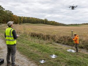
Hiring the wrong crew for aerial work can cost you weeks. An aerial surveyor is a land surveyor who maps your site from the air, using drones or planes instead of only ground crews. The data looks impressive on a screen. That doesn’t always mean it fits your project.
Before you sign anything, ask hard questions. The right questions up front save money, prevent rework, and keep your schedule intact. This is what to cover before the first flight.
What Accuracy and Mapping Detail Will the Aerial Surveyor Provide?
Start with accuracy, because it drives everything else. Ask the surveyor what accuracy level the final map will meet and how they measure it. A map that is off by inches can wreck a grading plan or a design drawing.
Accuracy is not one number. It breaks into several parts, and each one matters. Ask about these:
- Horizontal and vertical accuracy, stated in real units
- Point density, or how many measured points per area
- Image resolution, often listed as ground sample distance
- Terrain detail, meaning how well small changes in grade show up
Match the specs to how you will use the data. A rough concept map needs less detail than a design-grade survey. Tell the surveyor the end use, so they don’t over-build or under-build the product.
Get the accuracy claim in writing. A good land surveyor will state it plainly and back it with a method. If the answer is vague, treat that as a warning.
How Will the Aerial Survey Capture Difficult or Changing Site Conditions?
Every site has problem spots, and aerial data struggles with some of them. Ask how the crew will handle features that block or confuse the sensors. This tells you how much of your site will actually be usable data.
Common trouble spots include:
- Heavy tree cover that hides the ground
- Steep slopes and deep cuts
- Tall structures that cast shadows
- Stockpiles and material that shift day to day
- Active construction with moving equipment
Trees are the classic problem. A camera sees the top of the canopy, not the dirt below. Ask whether they’ll use LiDAR, extra ground shots, or a return visit to fill those gaps.
Changing sites need a plan too. If your project moves fast, the data can go stale in days. Ask how fresh the survey will be and how they handle areas that change during the flight window.
What Ground Control and Field Verification Will the Project Require?
Aerial data needs ground truth to be trusted. Ask how the surveyor will set ground control points and check the results in the field. Skipping this step is how bad maps slip through.
Ground control points are marked spots on the site with known coordinates. The crew ties the aerial data to these points to lock in position and elevation. Ask how many they’ll place and how they spread them across the site.
Field verification is the second check. The surveyor visits and measures a sample of points on the ground, then compares them to the aerial map. If the numbers match, you can trust the data. If they drift, you know before it costs you.
For a big or high-stakes project, don’t skip either step. A land surveyor who plans control and field checks up front is protecting your budget. One who waves it off is cutting a corner you will pay for later.
Which Aerial Survey Deliverables Will Work Best for Your Project?
You pay for deliverables, so know what you actually need. Ask the surveyor to explain each product and what it is good for. Ordering the wrong ones wastes money and time.
Common aerial deliverables include:
- Orthophotos, which are corrected aerial images you can measure on
- Digital elevation models that show the shape of the land
- Point clouds, or dense 3D data for detailed design
- Contour lines for grading and drainage work
- Volume reports for stockpiles and earthwork
Not every project needs all of these. A marketing image is cheap. A design-grade point cloud is not. Ask which files your engineer or architect will actually open and use.
Also ask about format. Your design team needs files that drop into their software without a fight. Confirm the file types before the work starts, not after delivery.
What Site, Weather, and Regulatory Factors Could Affect the Survey?
Aerial work depends on conditions you can’t fully control. Ask what could delay or block the flight so you can plan around it. A surprise here can push your whole schedule.
Site access comes first. The crew may need to reach the ground for control points, even on a fenced or active site. Sort out permission and safety before the flight date.
Weather grounds drones and planes fast. Wind, rain, and low light all hurt data quality. Ask how the surveyor handles bad weather and what their backup dates look like.
Airspace rules matter too. Flights near an airport, a helipad, or restricted zones need clearance, and that takes time. Ask whether your site sits in controlled airspace and how they’ll get approval. Sites near major cities and flight paths often need extra clearance, so confirm this early.
Frequently Asked Questions
What is an aerial surveyor?
An aerial surveyor is a land surveyor who maps sites from the air. They use drones or aircraft fitted with cameras or LiDAR sensors. The data becomes maps, elevation models, and 3D point clouds. Ground crews still set control points and check the results for accuracy.
How accurate is aerial survey data?
Accuracy depends on the equipment, flight height, and ground control used. Well-run drone surveys can reach centimeter-level accuracy on open ground. Heavy tree cover and poor control reduce that accuracy. Always ask the surveyor to state the accuracy in writing and explain how they measure it.
Do I still need ground control points with aerial mapping?
Yes, for most projects you do. Ground control points tie the aerial data to real-world coordinates. Without them, the map can drift in position and elevation. They are a key reason a professional aerial survey can be trusted for design work.
What deliverables come from an aerial survey?
Common products include orthophotos, digital elevation models, point clouds, and contour lines. Some projects also get volume reports for stockpiles or earthwork. The right mix depends on how you plan to use the data. Ask your engineer or architect which files they need before you order.
How long does an aerial survey take?
The flight itself is often quick, sometimes under a day for a small site. Processing the data and checking it takes longer, usually several days. Weather, airspace approval, and site access can add time. Ask for a full timeline that covers both the flight and delivery.
For a free land surveying quote, call us at (571) 200-9937 or send us a message by going here.
Posted in land surveying, land surveyor | Tagged LiDAR mapping
