
How Surveying Companies Support Property Decisions Before Construction Starts
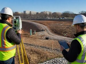
Every construction project starts as a plan on paper. That plan is only as good as the site information behind it. Guess at the boundaries or the grades, and those guesses turn into change orders once crews show up. Due diligence surveys give developers and builders the field facts they need before decisions lock in. A surveying company measures what is actually there, then hands the team a reliable base to build on. This article shows how the right survey work, ordered early, steadies the choices made before the first shovel hits dirt.
Why Pre-Construction Decisions Depend on Reliable Site Information
Owners, builders and developers make big calls early. Where the building sits. How the site drains. What the project costs. Each of those calls rests on what the team believes about the property.
Beliefs are the problem. A boundary that looks obvious from the street may sit feet away from where the deed puts it. An elevation guessed from a quick walk can be off by enough to wreck a drainage plan. An access point that seems fine might cross land you don’t control. Build a design on those assumptions, and the errors surface later as expensive fixes.
Surveying companies replace the guesswork with measured facts. A licensed surveyor visits the site, checks the records and reports the real conditions. That field-verified data lets the team decide with confidence instead of hope. Good information early is cheap next to a redesign after construction starts.
The timing matters as much as the data. A survey done before plans are final shapes the design in a useful way. A survey done after the fact just confirms what already went wrong. Order it early, and it works for you.
How Surveying Companies Help Confirm Boundaries, Access, and Existing Conditions
Before a design gets locked, several things on the property need a hard check. A surveying company confirms what is real and where it sits. That answer decides where new work can go.
Common items a survey confirms include:
- The property boundaries and how they line up with the record
- Existing structures already standing on the site
- Driveways and access points, and whether they stay on your land
- Easements that give others rights across the parcel
- Utilities and visible site features that affect layout
Put together, these show the true shape of what you own. You learn how much room you actually have. You see where a building, a drive or a utility line can realistically fit. That picture keeps early plans grounded in the real site instead of an idealized one.
Matching the Right Survey Service to the Planned Construction Project
Not every project needs the same survey. Part of a surveying company’s job is helping you pick the right one. Order the wrong service, and you pay for work you don’t need or miss information you do.
Here is how the common survey types line up with project needs:
- A boundary survey sets your property lines and corners.
- A topographic survey maps the grades, contours and features across the site.
- Construction staking marks where crews should build once design is done.
- An ALTA survey supports purchases and lending with a detailed title-related report.
- An elevation survey establishes heights, often for flood or drainage work.
- Existing-conditions mapping records what is on the site today for designers to work from.
Many projects need more than one of these. A developer might start with a boundary and topographic survey, then add construction staking later. Talking with a surveyor early helps you sequence the work. You get the right data at the right time, without paying twice.
How Survey Data Supports Architects, Engineers, and Contractors
Once the survey is done, the whole design team runs on it. Architects and engineers treat the survey as their base map. Every line they draw sits on top of that measured reality.
Accurate site information shapes the technical work in direct ways:
- Building placement, so the structure fits inside the lines and setbacks
- Grading, so the site sits at workable heights
- Drainage design, so water moves where it should
- Access planning, so drives and entrances land in legal spots
- Utility coordination, so new lines tie in without conflict
The survey also gives everyone a shared reference. The architect, the engineer and the contractor all read from the same set of facts. That common base cuts down on the small disagreements that slow a job. When a question comes up about a line or a grade, the survey answers it.
Accuracy here pays off down the line. A design built on solid existing conditions needs fewer corrections during construction. Fewer corrections mean fewer delays and a tighter budget.
Why Early Coordination With a Surveying Company Can Reduce Construction Changes
The most expensive site problems are the ones found late. A crew already on site costs money every day. Discovering a boundary issue or a hidden easement at that stage forces a scramble. Early survey work heads that off.
A surveying company brings constraints to the surface before crews mobilize. Some of the findings that show up include:
- A boundary that sits in a different spot than assumed
- An easement crossing the planned build area
- Elevation changes that affect grading or drainage
- Existing improvements that conflict with the new layout
Each finding is a chance to adjust while adjusting is still cheap. Learn about an easement early, and the designer moves the building on paper. Discover it after the foundation is poured, and the fix costs real money and weeks of time. Early information buys you room to change designs, rework budgets and reset schedules on your terms.
Coordination is the practical piece. Bring a licensed surveyor into the project during planning, not after. Share your goals so the fieldwork focuses on what your build needs. Since permit rules and record systems vary by area, a surveyor working from current local information helps your plans match what your jurisdiction expects. Handled in that order, the survey does more than measure the land. It protects the whole project that gets built on it.
For a free land surveying quote, call us at (571) 200-9937 or send us a message by going here.
Posted in land surveying, land surveyor | Tagged Land Surveying, Land Surveyor
