
How a Flood Elevation Certificate Can Help Clarify a Home’s Flood Exposure
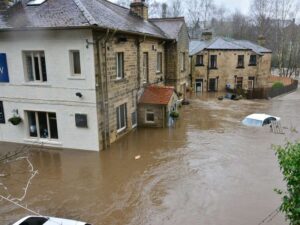
A home can sit in a flood zone on paper and still stand high and dry. Or it can look safe and flood every heavy storm. A flood elevation certificate settles the question. It measures exactly how high the home sits against the base flood level, so you stop guessing about the risk. For anyone buying or building in Arlington, that number can change the whole deal.
Flood risk is easy to misread. A map shows a broad zone, not your specific lot. Two homes on the same street can face very different odds. The certificate cuts through the map and speaks to one property. That is why it matters so much.
What This Document Actually Measures on Your Lot
A flood elevation certificate is a form filled out by a licensed surveyor. It records the real elevations of a specific building. The surveyor visits the site and shoots exact heights. Those numbers go on a standard FEMA form.
The key figure is your lowest floor height. The form compares it to the base flood elevation, the level floodwater is expected to reach. If your floor sits above that line, your risk drops. If it sits below, the risk climbs. That gap is the heart of the whole document.
The form captures more than one height. It notes the ground around the building. It records any crawl space or basement. It logs machinery like an HVAC unit if it sits low. Each height helps show how water would reach the home.
Why Arlington’s Terrain Makes Elevation So Hard to Judge by Eye
Arlington is far from flat. The land rolls, dips, and drops toward creeks and the river corridor. A lot near Four Mile Run sits very differently from one up on a ridge. The eye cannot measure those differences. A survey can.
Small elevation changes carry big weight near water. A few feet up or down can move a home in or out of real danger. A yard that looks level may slope just enough to send water at the foundation. Only measured heights tell the true story.
The flood maps show broad zones across the county. They do not capture the exact rise and fall of your parcel. Your lot may sit higher than the zone suggests, or lower. The certificate checks the ground itself, not the map’s best guess.
How Buyers and Developers Use the Numbers
A flood elevation certificate turns vague worry into hard data. A buyer can see the real exposure before closing. A developer can judge whether a lot needs a raised design. The number drives the decision.
The certificate shapes how you build. If the lowest floor sits too low, you may raise it in the design. You may adjust the grade or the foundation type. You plan around the flood level instead of fighting it later. That is far cheaper than a fix after the home is up.
It can also affect flood insurance. Insurers may use elevation information when assessing flood risk and premiums. A certificate that documents the home’s elevation gives them property-specific information instead of relying only on a broad map designation.
When to Order One in the Deal or Build Timeline
Timing decides how useful the certificate is. Get it early, and it guides your choices. Get it late, and it only confirms what you already built. Early is almost always better.
For a purchase, order it during due diligence. That window lets you weigh the flood risk before you commit. You can renegotiate, plan a raised design, or reconsider the property. Wait until after closing, and your options may be more limited.
For a build, discuss the elevation requirements during the design stage. Depending on local requirements and the project, an elevation certificate may also be needed after construction to document the completed structure. Confirm the required timing with the local floodplain authority and your survey professional.
The Difference Between a Map Zone and a Measured Elevation
A flood map zone is a wide label. It covers a large area with one designation. It tells you the general flood risk, not your home’s exact elevation. Many owners stop there and misjudge the danger.
A measured elevation is specific to your building. It helps show how the structure’s elevations compare with the applicable flood elevation. That is a question a general map cannot answer by itself. The certificate helps fill the gap between the broad zone and the actual structure.
For an Arlington property near a creek or a low draw, that difference can matter. The map may place you in a zone that sounds alarming, while measured elevations provide more detail about the individual property. Or the measurements may reveal a concern that deserves closer review. Either way, you can make decisions using measured information rather than a map label alone.
A flood elevation certificate can provide valuable property-specific information about flood exposure. For a developer or buyer evaluating an Arlington property, that added detail can support better planning before money and construction commitments are on the line.
Frequently Asked Questions
Who can complete a flood elevation certificate?
A licensed land surveyor, engineer, or other professional authorized under applicable law may be able to complete and certify the form. Requirements can vary by location and the specific form being used. A qualified survey professional can determine what measurements are needed and whether they are authorized to certify them.
Does a flood elevation certificate lower my flood insurance cost?
It can provide information that an insurer may use when determining flood risk and premiums, but it does not guarantee a lower rate. The result depends on the property’s characteristics, applicable flood maps, insurance rules, and the insurer’s requirements. Ask your insurance provider how a current certificate would affect your policy.
How long is a flood elevation certificate valid?
There is not a simple universal expiration date for every certificate. Its usefulness depends on whether the structure, surrounding ground, flood maps, or applicable requirements have changed. A new addition, regrading, or updated flood information may mean that a new certificate or updated documentation is needed.
Do I need a certificate if my home is not in a flood zone?
You may not be required to have one, but property-specific elevation information can still be useful. Flood maps can change, and properties near waterways may benefit from more detailed elevation data. Check with your lender, insurer, and local floodplain authority to determine whether one is appropriate.
Is a flood elevation certificate the same as a flood zone determination?
No. They provide different information. A flood zone determination identifies the flood zone associated with a property based on applicable flood mapping, while an elevation certificate documents measured elevations of the structure and site. The two can be reviewed together to better understand a property’s flood exposure.
For a free land surveying quote, call us at (571) 200-9937 or send us a message by going here.
Posted in land surveying, land surveyor | Tagged Elevation Certificate
