
Elevation Certificate Before a Floodplain Renovation
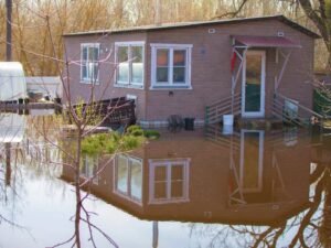
The most expensive renovation mistakes in a floodplain usually happen before anyone swings a hammer. A kitchen gets designed around a floor height nobody checked, or a new furnace ends up below the flood level the permit office expects. Then the plans come back for changes, and the schedule slips. An elevation certificate helps you avoid that by showing exactly how your building sits compared to expected flood levels. If your home or building is in a mapped flood zone, get current elevation data before your designer finalizes plans, since it can shape what you’re allowed to build and how.
Why Renovation Plans Need Verified Elevation Information
Renovation plans need verified elevation information because flood rules are based on heights, and guesses don’t hold up in review. Your designer, contractor, and local floodplain office all need to know where your floors, equipment, and ground sit compared to the flood level on the map. Without that data, everyone is working from assumptions.
Those assumptions can be costly. A basement finish might not be allowed if the floor sits too low. A mechanical upgrade may need to go higher than planned, which changes the layout and the budget.
Older homes carry extra risk here. Past additions, regrading, or fill work may have changed the site since any earlier survey was done. An old certificate or a rough estimate from a map viewer isn’t enough to design around with confidence.
What an Elevation Certificate Documents Before Work Begins
An elevation certificate is a FEMA form that records a building’s key elevations and its flood zone information. It’s completed by a licensed land surveyor, engineer, or architect, depending on what your community accepts. Many owners know it from flood insurance, but it’s just as useful during planning.
A typical certificate records details like these:
- The flood zone and the base flood elevation, if one is mapped
- The height of the lowest floor, including basements and crawlspaces
- The ground elevations right next to the building
- The height of equipment like furnaces, water heaters, and AC units
- The building type and details such as flood openings in foundation walls
The base flood elevation, often called the BFE, is the height floodwater is expected to reach during a flood with a 1% chance of happening in any year. It’s the main number your plans get measured against. Some flood zones don’t have a mapped BFE, and in those areas the local office may use other methods to set requirements.
Before and After Certificates
Many renovation projects involve more than one certificate. A “before” certificate shows current conditions and guides design. A certificate based on finished construction may be needed at the end to confirm the work matches the approved plans, so ask your local office which ones apply to your project.
Comparing Existing Floor Elevations With Floodplain Data
This comparison is where the certificate earns its value. Once the surveyor measures your lowest floor and equipment, those heights are compared to the base flood elevation. The result tells you whether key parts of the building sit above or below the expected flood level.
A floor that sits well above the BFE gives you more freedom in design. A floor that sits below it means your plans may need flood-resistant materials, raised equipment, or other changes. The gap between the two numbers often shapes the whole project.
Don’t overlook the smaller items. An outdoor condenser, an electrical panel, or ductwork in a crawlspace can sit lower than the living space. These are easy to miss in early planning, and they’re often where changes get required.
How Elevation Information Supports Permit and Design Review
Elevation data gives reviewers the facts they need to evaluate your plans. Local floodplain offices often ask for elevation information with permit applications for work in a mapped flood zone. Having it ready can help avoid back-and-forth requests that slow approval.
One rule matters a lot for renovations. Under federal flood program rules, work is treated as a substantial improvement if its cost equals or exceeds 50% of the building’s market value. When a project crosses that line, the whole building may need to meet current floodplain standards, which can include raising the lowest floor. Some communities set stricter limits or track costs over several years, so rules can vary by locality.
Your architect or engineer uses the same elevation data to plan compliant designs. Floor heights, stair layouts, flood openings, and equipment platforms all depend on accurate numbers. Getting the certificate early means the design reflects reality from the first draft.
Using Updated Survey Data to Reduce Renovation Risk
Updated survey data lowers your risk by replacing assumptions with measured facts. It helps you set a realistic budget, avoid redesigns, and move through permitting with fewer surprises. It can also give you useful information for flood insurance decisions after the work is done.
Here’s a practical order of steps before you start:
- Check whether your property is in a mapped flood zone
- Call your local floodplain office and ask what elevation data they need
- Hire a licensed surveyor to prepare a current elevation certificate
- Share the certificate with your designer before plans are finalized
- Confirm whether a final certificate will be needed after construction
Timing matters more than most owners expect. Surveyor schedules, permit review, and contractor start dates all stack up quickly. Order the survey early so the data is ready when your designer needs it.
For a free land surveying quote, call us at (571) 200-9937 or send us a message by going here.
Posted in Elevation Certificate | Tagged Elevation Certificate
