
ALTA Land Survey Checks Before an Office-to-Housing Deal
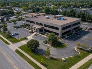
Turning an old office building into homes sounds straightforward. The walls are already up. The lot is already there. But the site underneath can hold surprises that change the whole plan. An ALTA land survey is how a developer finds them early. It maps the boundaries, the easements, and every improvement on the property. Before an office-to-housing deal moves forward, that map is one of the first things worth having.
The Property Needs a Different Kind of Due-Diligence Review
An office site and a housing site are not judged the same way. Office use is forgiving in some ways. Shared parking, wide drive aisles, and a single main entrance all work fine. Housing asks different questions of the same ground.
A change in use raises the stakes on the details. Setbacks, unit access, and open space start to matter more. What passed for an office may not fit homes. So the review has to go deeper than a normal purchase check.
An ALTA land survey fits this need well. It documents the site to a national standard that lenders and title companies trust. It records the lines, the easements, and the features on the ground. That record gives the project team a solid base to plan from.
Easements That Could Complicate Residential Conversion
An easement is a right for someone else to use part of the land. Utility lines, access routes, and drainage areas often come with one. An office may have lived with these rights for years without trouble. A housing plan can bump into them fast.
Take a shared driveway between two properties. That access might feel minor for an office. Add residents, cars, and daily traffic, and it can turn into a real limit. The same is true for a utility easement that crosses the best spot for a new building.
An ALTA land survey shows recorded easements on the drawing. The team can see where each one runs and how wide it is. Some will sit clear of the work. Others may block a driveway, a wall, or a whole wing of units. Knowing this early keeps a design from being drawn twice.
Existing Improvements Against the Recorded Property Lines
Every office site comes with built features. There’s the building itself. There’s parking, sidewalks, fences, signs, and drive lanes. An ALTA land survey plots each one against the true property lines.
That comparison can reveal a problem. A parking area might spill past the line onto the neighbor’s land. A fence might sit well inside the boundary. A corner of the building could even cross a setback. These are called encroachments, and they matter more during a big change in use.
An encroachment can stall a conversion. It may need a fix, an agreement, or a redesign before work starts. Finding it on the survey gives the team time to handle it. Finding it during construction costs far more.
Parking and Access Under a New Residential Layout
Parking rules shift when offices become homes. An office counts spaces for daytime workers. Housing counts spaces for residents and guests, often overnight. The existing lot may hold too few spaces, or the wrong layout.
Access points matter just as much. Office traffic tends to flow in and out at set hours. Residents come and go all day and night. The current entrances, drive aisles, and curb cuts may not suit that pattern. Some may need to move.
The survey maps all of this as it stands today. It shows the parking areas, the drive lanes, and each point where the site meets the road. Designers use that to test their unit plans against real limits. A layout that ignores the existing access can fall apart at review.
Site Conditions That Can Shape the Conversion Plan
Each finding on the survey feeds the bigger plan. Boundaries set the outer limits. Easements carve out no-build zones. Improvements and encroachments flag spots that need attention. Access and parking shape how units and drives can sit.
Put together, these facts draw the true edges of what’s possible. A developer can see the constraints before spending on full design. That saves money and avoids plans that can’t be built. It also gives lenders and partners a clear view of the risk.
An ALTA land survey won’t design the project for you. It gives the team the ground truth to design around. With that in hand, the conversion starts from facts instead of guesses. That’s a stronger place to begin a deal of this size.
Frequently Asked Questions
What is an ALTA land survey?
An ALTA land survey is a detailed property survey made to a national standard. It maps boundaries, easements, improvements, and other recorded interests on the site. Lenders and title companies often require it for commercial deals. Developers use it to understand a property before they buy or build.
Why does an office-to-housing conversion need one?
A change from office to housing raises new questions about the same site. Parking, access, and setbacks all get judged by different rules. An ALTA land survey documents the current conditions the new plan must work around. That helps the team spot limits before design and construction begin.
What problems can the survey reveal?
The survey can show easements that block the best build spots. It can reveal encroachments, where a fence or paving crosses a property line. It can flag parking and access that no longer fit the planned use. Each of these can change the design or the budget if found late.
How is an ALTA survey different from a basic boundary survey?
A boundary survey mainly shows where the property lines run. An ALTA land survey goes further and follows a set national standard. It adds easements, improvements, encroachments, and title-related details to the picture. That extra depth is why lenders ask for it on larger commercial deals.
When should a developer order the survey?
Order it early, during the due-diligence period before closing. The findings can affect the price, the design, and the decision to move ahead. Waiting until after purchase removes your room to negotiate. An early survey gives the team time to plan around what it finds.
For a free land surveying quote, call us at (571) 200-9937 or send us a message by going here.
Posted in land surveying, land surveyor | Tagged ALTA Survey
